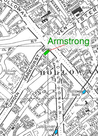
This page provides two maps. The first shows where the Armstrong factory was located up until around 1980. The factory is shown in green. The main entrance was in Warlters Rd, but the factory was parallel to the Parkhurst Rd.
The nearby underground stations are shown in blue.
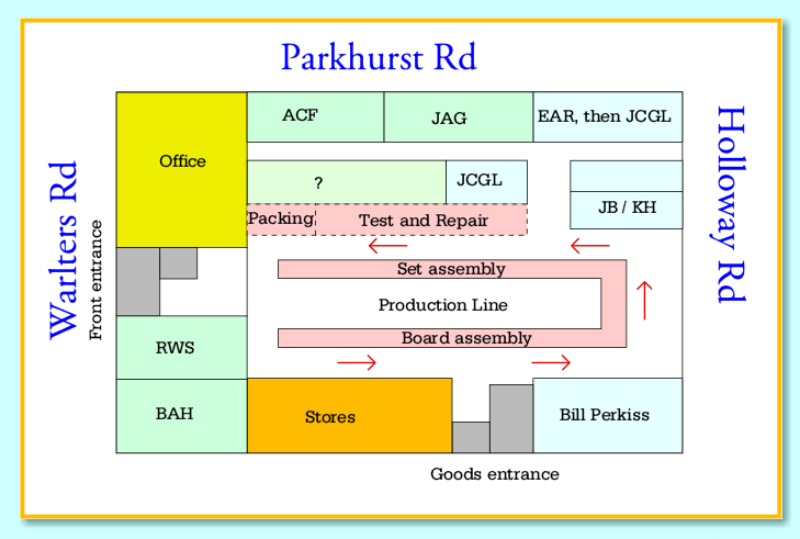
The second map is the diagram above. This indicates the layout of the factory offices, production line, etc, as they were arranged towards the end of the 1970's. Much the same general layout was used during the 1960's. The diagram shows the first floor. Below this was a shopping arcade. This was the period during which the firm made the 600 range. Rooms in pale blue were used for development or production control and management. Areas in green were used for general management and by the directors. The grey areas were the stairs. The red arrows indicate the direction of progress of units under construction.
Click on the logo to return to the home page.
Content and pages maintained by: Jim Lesurf using HTMLEdit and TechWriter on a StrongARM powered RISCOS machine.